


Jurassic and World Heritage Coast
Our World Heritage Coast starts at Orcombe Rocks near Exmouth, East Devon and finishes at Old Harry Rocks in Studland Bay, East Dorset. West Bay forms a major gateway to the Jurassic Period of this coastline, to the extent that its new West Pier has been named 'The Jurassic Pier'.
This is England's first natural World Heritage Site and was designated as such by UNESCO (United Nations Educational, Scientific and Cultural Organisation) on 13th December 2001, following the efforts of the Dorset Coast Forum. The site was officially opened by Prince Charles on 3rd October 2002 at Orcombe Point, just east of Exmouth. It now joins the ranks of the Great Barrier Reef and the Grand Canyon as one of the Natural Wonders of the World.
History
As the coastal rocks gently tilt downwards to the east, the oldest cliffs are around the Exmouth area at about 250 million years old, while the youngest are at Studland, about 65 million years old. They were formed in a tropical sea, flooding the desert which had existed before that time. Giant sea reptiles ruled supreme. About 140 million years ago, sea levels dropped again giving rise to forests, swamps and lagoons. Dinosaurs ruled the Earth. Then about 100 million years ago sea levels rose again, flooding the area under another vast tropical sea.
At that time, East Devon and Dorset were close to the equator and enjoying Bahama style tropical weather. Tropical sea flooding of the land and land mass shifts pushed Devon and Dorset northwards to where they are today. The Ice Age followed with huge glaciers forming to gouge out valleys and reshape the land profile, including Devon and Dorset's cliffs, though they weren't by the sea...yet. During the ultimate thaw around 10 thousand years ago, sea levels rose and flooded the low lying land, thus forming the North Sea and English Channel. Britain was suddenly cut off from mainland Europe, trapping animals and humans on our island.
Lyme Bay's coastline takes in most of the Triassic and Jurassic Coast, where cliff faces and rock falls can expose up to 250 million years of history. The cliff and coastal walks also form part of the South West Coast Path.
This Geological timeline is the Mesozoic (second geological or middle life) Period.......65 to 250 million years ago and is split into the following 3 periods:
The Triassic Period.......200 to 250 million years ago.
The Jurassic Period.......140 to 200 million years ago.
The Cretaceous Period.......65 to 140 million years ago.
The spin of the Earth has slowed down over time and during the Mesozoic Period an Earth day was probably around 22 or 23 hours long. Before our Moon was formed, the spin of the Earth may have been about 8 times faster than it is now!
Most of East Devon is within the Triassic Period. This includes the towns of
Exmouth, Budleigh Salterton, Sidmouth, Branscombe, Beer, Seaton and Axmouth.
Most of West Dorset is within the Jurassic Period. This includes the towns of Lyme Regis,
Charmouth, Seatown, Eype, West Bay, Burton Bradstock, Abbotsbury and Portland Isle.
Most of East Dorset is within both the Jurassic and Cretaceous Periods. This includes the
towns of Weymouth, Lulworth, Swanage and Studland.
200 Million Years Ago

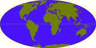
Land masses 200 million years ago (Britain is shown in Red) Position of continents today
In the early Triassic Period, Earth's continents were all connected as one landmass called 'Pangaea' (Greek, meaning 'All Lands'). This supercontinent was surrounded by one gigantic ocean called 'Panthalassa'. In the early Jurassic Period, Pangaea began to break into 2 landmasses; 'Laurasia' and 'Gondwanaland'. Laurasia (moving northwards) consisted of the present day continents of North America, Europe and Asia. Gondwanaland (remaining in the south) consisted of the present day continents of Antarctica, Australia and South America. India at that time was also part of Gondwanaland and very distant from Asia. Britain bathed in tropical waters about 15° north of the equator in part of the 'Thethys Sea', later to form the Mediterranean Sea. Summers were hot and dry, while winters were hot and wet. Ice and snow for the polar caps were still in Earth's future.
This landmass breakup was (and still is) caused by convection currents in the upper zone of the Earth's mantle. This generates movement in the mantle, causing the surface plates to move slowly across the Earth's surface.